Addington lies between the village of Wrotham Heath and the town of West Malling and is very close to the M20 and A20. In the Domesday Book of 1086, it was known as Eddintune which originally took its meaning from “Æddi’s (or Eadda’s) estate”.
The village is notable for its two long barrows, the Chestnuts Long Barrow and the Addington Long Barrow. Long Barrows are neolithic chamber tombs. It is hard to estimate how old the tombs are. Some online sources suggest they may be six or seven thousand years old, while the Addington Parish Council website says that it may be something more like four or five thousand years. The Long Barrows are similar to many monuments found all the way from the United Kingdom through Europe to India and reflect the ancient roots of humanity. Many Neolithic artifacts have been extracted from the village, but much archaeological evidence has been lost to mechanical digging from the nearby quarries which are now almost entirely dug out.
Addington has been continuously inhabited for over 5,000 years. It had two mills at the time of the Domesday survey. An old watermill, powered by the Addington Brook stream, was demolished in the nineteenth century. The site of the watermill now lies within the land that belongs to West Malling Golf Club. The Golf Club and course sit towards the edge of the village on the land that borders the A20 road.
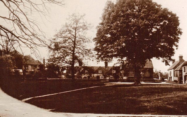
Today the village of Addington is populated by just under 1,000 people in 291 houses that surround the green. While St Margaret’s was probably the original centre of the village, the Angel Inn and the Green adjacent are now recognised as the de-facto local centre. There are rumours of an undergound tunnel between the church and the pub, but we haven’t found it yet!